
Always
know the
way home
on Mars.

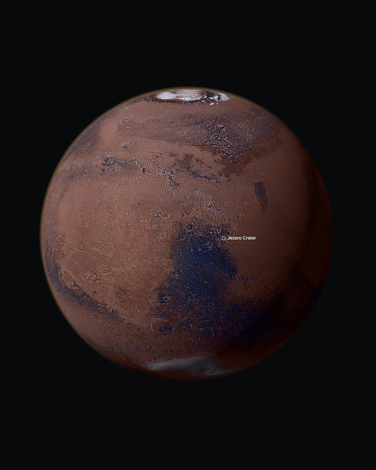
Mars on SIMER's opening 3D globe, with Jezero Crater marked north of the equator.
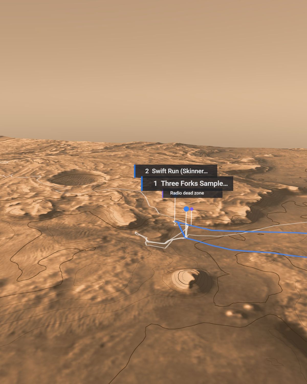
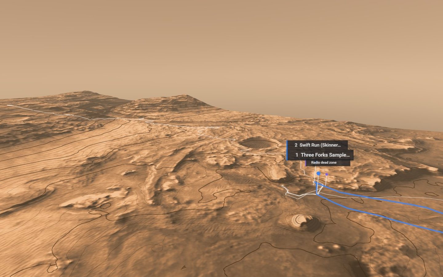
Jezero Crater on SIMER's 3D terrain model, with contour lines, the planned walk in blue and its labelled stops.
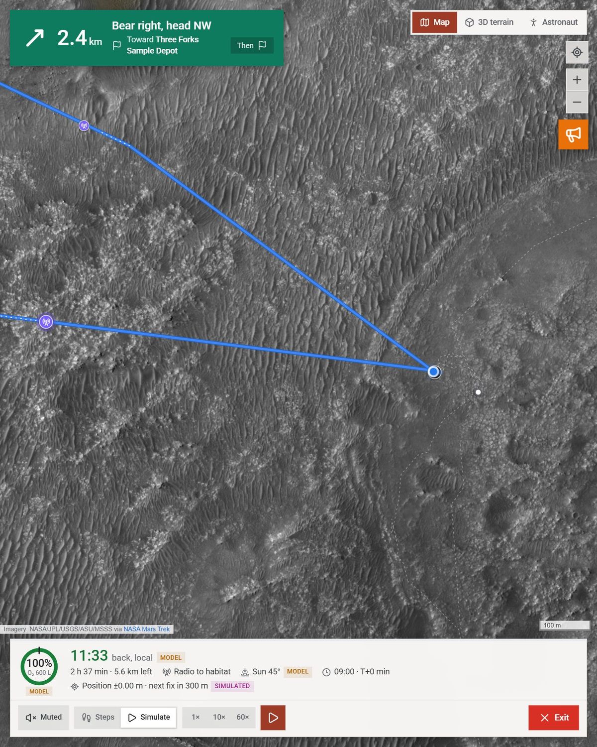
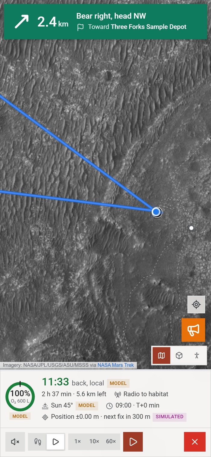
Live navigation on HiRISE imagery: a turn banner reading Bear right, head NW, 2.4 km toward the Three Forks Sample Depot, the route in blue and the oxygen dial at 100%.
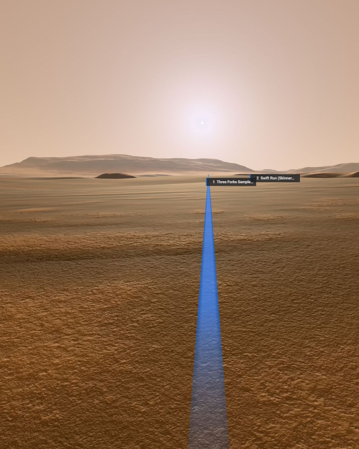
Late afternoon in the astronaut view at Jezero, the route running toward a low, haloed sun.

The app opens on Mars. Search 600 named places, or pick Jezero to plan a walk.

1 / 4

SIMER plans a Marswalk at Jezero Crater on real NASA data, warns the crew about each hazard before they reach it, and explains every GO, CAUTION or NO-GO with a number.

See how it works

Right now, a message from Earth takes 11.0 minutes to reach Mars.

A question to Mission Control and back takes 22 minutes, so every call on a Marswalk is made on Mars, by the crew. SIMER is the map they make it with.

One plan, three screens.

The crew plans in the habitat, follows the route on a tablet they carry, and looks through a visor on the walk. The same planner and the same numbers sit behind every screen.

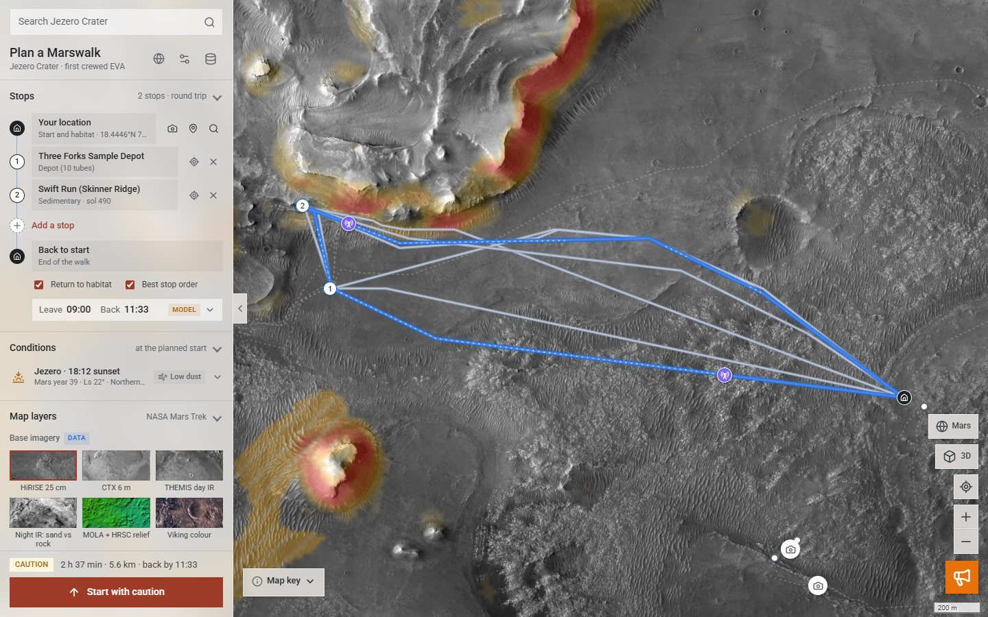
SIMER's planning view: a glass side panel with stops, conditions and map layers, and four routes over HiRISE imagery of Jezero.

Plan in the habitat

Pick the stops. SIMER searches the 20 m terrain model for four routes, balanced, fastest, safest and max science, and checks oxygen, slopes, sand, radio and daylight at every step.

Live navigation on a phone: a turn banner, the route over HiRISE imagery, and the oxygen dial with time back at the habitat.

Walk with the tablet

A turn banner, an oxygen dial and a warning before each hazard. The walker moves with your steps or a simulation, and Head home now replans the fastest way back.

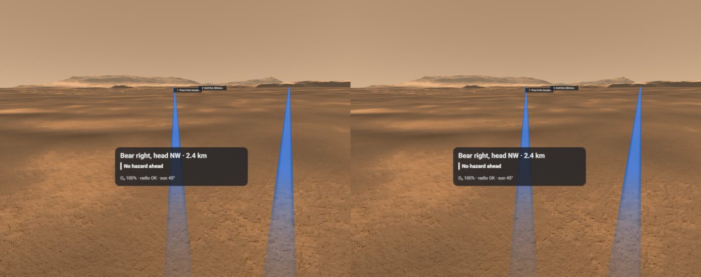
The Google Cardboard view: side-by-side stereo of the astronaut view with the route and a HUD reading Bear right, head NW, 2.4 km, no hazard ahead.

Look through the visor

The same phone goes into a Google Cardboard. The astronaut view puts HiRISE ground at your feet, the route on the horizon and the next turn in a HUD strip.

Every call comes with its reason

  1. Caution

    The default walk is out of radio line of sight with the habitat for up to 1 h 02 min, with a 10 m mast.

  2. Habitat radio mast · 20 m

    ASSUMPTION

    The mast height is one of the assumptions the crew can change, like suit oxygen, slope limits and the walk-back margin.

  3. Go

    The Balanced route is GO with 95% radio contact. Verdicts come from written rules, each reason stated with its number.

Default walk: habitat, Three Forks sample depot, Swift Run, and back.

Distance
5.60 km DERIVED
Time with stops
2 h 37 min MODEL
Oxygen used
152 L MODEL
Left at the end
448 L MODEL
Worst walk-back margin
×9.35 MODEL
Four routes planned in
288 ms

Earth date 14 Nov 2026, Mars Year 39, Ls 22°. The walk-back rule asks for ×1.25 the oxygen needed to get home at every step. Computed by the planner, not measured on Mars.

  • Every number in the app says where it came from:
  • DATAmeasured by a mission
  • DERIVEDcomputed from mission data
  • MODELfrom a physical model
  • ASSUMPTIONa rule the crew can change
  • SIMULATEDa demo event, never real weather

One map, every mission’s data.

Imagery and measurements from six NASA missions and ESA’s Mars Express, layered over the Jezero delta, plus SIMER’s own layers computed from the terrain: walking hazard, slope, science value, survival envelope and radio coverage.

Jezero Crater on SIMER's 3D terrain model, with contour lines, Perseverance's traverse and the planned walk.

Jezero on the 20 m CTX terrain model in SIMER’s 3D view, with contour lines, Perseverance’s traverse and the planned walk.

The planner works on the 20 m terrain model. Close up, the map lays 25 cm HiRISE imagery over the coarser base maps, so the crew sees the ground the planner cannot.

LayerSourceScale
HiRISE mosaicMars Reconnaissance Orbiter25 cm
CTX orthomosaicMars Reconnaissance Orbiter6 m
CTX terrain modelMRO · USGS Astrogeology20 m
THEMIS day infraredMars Odyssey100 m
MOLA + HRSC reliefMars Global Surveyor · ESA Mars Expressblended
Viking colour mosaicViking orbitersMDIM 2.1
Geologic map SIM 3464USGS · Sun & Stack 2020units
Perseverance traverseMars 2020sols 13–2022
Sample sitesMars 202028 sites
Surface radiation doseCuriosity RAD0.64 mSv/day
Sun, season and timeNASA GISS Mars24model

Mars has no GPS.

A suit tracks itself by dead reckoning, which drifts with every metre walked. SIMER-Loc tries to fix that the way JPL’s Mars Global Localization does for Perseverance: match the ground around the walker to the HiRISE orbital map.

It works on simulated views. On real Perseverance Navcam images it does not work yet, so the app never uses a failed fix as a position. The start comes from JPL’s position, a pin or a typed place.

TestResult
Simulated rover views at real Perseverance positions96 of 96 within 1 m
Real MRO CTX patches found on the HiRISE map238 of 238 within 15 m
A 2.4 km drive with a fix every 300 mnever more than 13 m off, against 20 m without fixes
Real Perseverance Navcam images at 26 stops0 within 1 m, median miss about 35 m. Not working yet.

What the map can’t see yet.

  • 20 m terrain. Rocks smaller than one cell are invisible to the planner, so the crew still has to look.
  • Oxygen is a model. A load-carriage equation scaled to Mars gravity, not a suit test.
  • Storms are simulated. No public feed gives dust storms at route scale, so demo events say SIMULATED. The habitat site is notional.
  • A research prototype. Built for a hackathon, not flight software.

Next: 1 m HiRISE terrain with boulder detection, suit-test metabolic data, and self-location that holds up on real Navcam images.